Artists › Vincent van Gogh
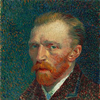
Vincent van Gogh: sketches and drawings
Pen, ink and the south of France · 1853–1890
Vincent van Gogh (1853–1890): pen, ink and the south of france. SketchMap Atlas shows 5 sketches by Vincent van Gogh on the world map, each placed where it was drawn.
Dutch post-impressionist painter. In 1888 he settled in Arles in the south of France and drew the streets, cafés and fields around him with a reed pen and ink, and spent a few days on the coast at Saintes-Maries-de-la-Mer in June. He died in 1890, leaving hundreds of drawings alongside his paintings.
Sketches by Vincent van Gogh and where they were drawn
See Vincent van Gogh’s sketches on the map
Every sketch is pinned where it was drawn, so you can follow Vincent van Gogh from place to place.
Open in the map
Been to one of these places? Add your own sketch next to Vincent van Gogh’s.
Where did Vincent van Gogh draw each work?
- Café Terrace, Arles (September 1888): drawn at Place du Forum, Arles (43.6783° N, 4.6280° E). Details
- The Langlois Bridge (March 1888): drawn at Canal near Arles. Details
- Street in Saintes-Maries-de-la-Mer (July 1888): drawn at Saintes-Maries-de-la-Mer (43.4523° N, 4.4283° E). Details
- View of Saintes-Maries-de-la-Mer (June 1888): drawn at Saintes-Maries-de-la-Mer. Details
- Rocks at Montmajour (July 1888): drawn at Montmajour Abbey, Arles (43.7085° N, 4.6637° E). Details
About the works
- Café Terrace, Arles, September 1888. Place du Forum in reed pen: the same subject as the night painting of 1888. Source · Public domain
- The Langlois Bridge, March 1888. The drawbridge on the canal near Arles, to which Van Gogh returned in the spring of 1888. Source · Public domain
- Street in Saintes-Maries-de-la-Mer, July 1888. Thatched roofs and a dusty white road: pen and ink from a trip to the sea. Source · CC0
- View of Saintes-Maries-de-la-Mer, June 1888. The fortified church above the fields, sun rays in hatching: a sketch from the south of France. Source · Public domain
- Rocks at Montmajour, July 1888. A pine on limestone near Montmajour Abbey, where Van Gogh drew in the summer of 1888. Source · Public domain
Quick answers
Who was Vincent van Gogh?
Dutch post-impressionist painter.
Where did Vincent van Gogh draw?
Arles, Canal near Arles and Saintes-Maries-de-la-Mer. Every sketch is shown on the map at the place where it was made.
What techniques did Vincent van Gogh use?
The works on SketchMap Atlas are drawing.
Can I use the sketches by Vincent van Gogh?
The works shown here are marked “CC0, Public domain” and come from Wikimedia Commons. Check the source link of each work for the exact terms.
More artists

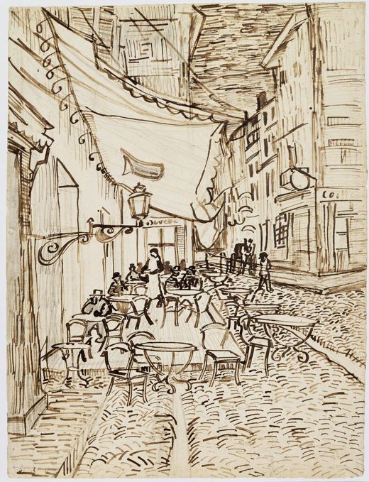 Café Terrace, Arles
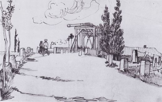 The Langlois Bridge
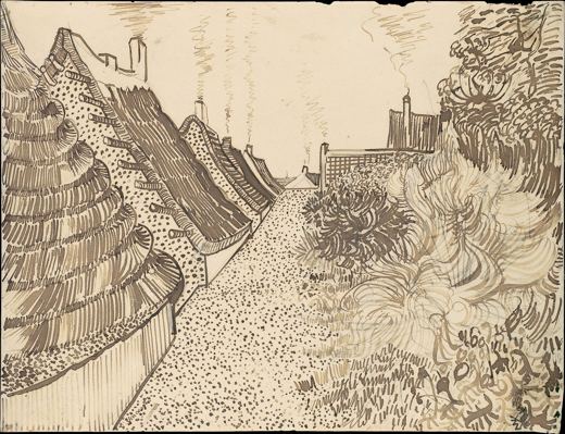 Street in Saintes-Maries-de-la-Mer
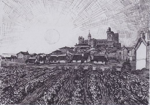 View of Saintes-Maries-de-la-Mer
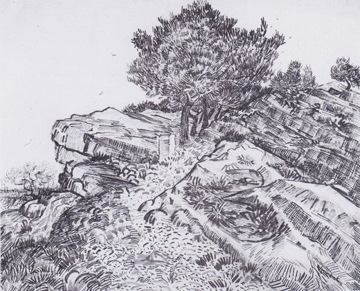 Rocks at Montmajour
 Rembrandt van Rijn
 Canaletto
 Albrecht Dürer


